


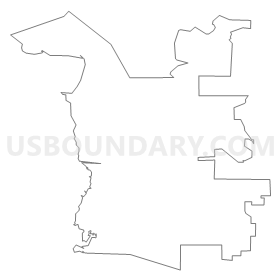
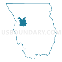
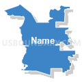
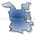
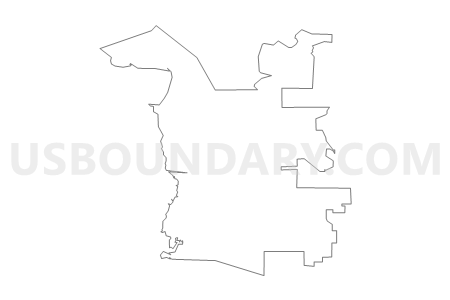
Benson Voting District, Cache County, Utah
About
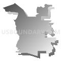
Outline
Summary
| Unique Area Identifier | 678557 |
| Name | Benson Voting District |
| County | Cache County |
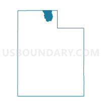
| State | Utah |
| Area (square miles) | 26.60 |
| Land Area (square miles) | 22.50 |
| Water Area (square miles) | 4.09 |
| % of Land Area | 84.61 |
| % of Water Area | 15.39 |
| Latitude of the Internal Point | 41.79112480 |
| Longtitude of the Internal Point | -111.92735280 |
Maps

Graphs
Select a template below for downloading or customizing gragh for Benson Voting District, Cache County, Utah


Neighbors
Neighoring Voting District (by Name) Neighboring Voting District on the Map
- Amalga Voting District, Cache County, UT
- College Young 01B Voting District, Cache County, UT
- Hyde Park 01 Voting District, Cache County, UT
- Hyde Park 02 Voting District, Cache County, UT
- Logan 04 Voting District, Cache County, UT
- Logan 25 Voting District, Cache County, UT
- Logan 30 Voting District, Cache County, UT
- Logan 31 Voting District, Cache County, UT
- Mendon 01 Voting District, Cache County, UT
- Newton Voting District, Cache County, UT
- Smithfield 06 Voting District, Cache County, UT
- Smithfield 07 Voting District, Cache County, UT
Top 10 Neighboring County Subdivision (by Population) Neighboring County Subdivision on the Map
- Logan CCD, Cache County, UT (78,094)
- Smithfield CCD, Cache County, UT (12,379)
- Wellsville CCD, Cache County, UT (6,117)
Top 10 Neighboring Place (by Population) Neighboring Place on the Map
- Logan city, UT (48,174)
- Benson CDP, UT (1,485)
- Amalga town, UT (488)
- Peter CDP, UT (324)
- Cache CDP, UT (38)
Top 10 Neighboring Unified School District (by Population) Neighboring Unified School District on the Map
Top 10 Neighboring State Legislative District Lower Chamber (by Population) Neighboring State Legislative District Lower Chamber on the Map
- State House District 5, UT (43,319)
- State House District 3, UT (38,268)
- State House District 2, UT (34,283)
Top 10 Neighboring State Legislative District Upper Chamber (by Population) Neighboring State Legislative District Upper Chamber on the Map
Top 10 Neighboring 111th Congressional District (by Population) Neighboring 111th Congressional District on the Map
Top 10 Neighboring Census Tract (by Population) Neighboring Census Tract on the Map
- Census Tract 3, Cache County, UT (7,492)
- Census Tract 13, Cache County, UT (6,117)
- Census Tract 4.03, Cache County, UT (5,754)
- Census Tract 2.01, Cache County, UT (3,228)